Program "Geodesy"
BECOME A GEODESIST: DISCOVER THE WORLD FROM A NEW ANGLE
The "Geodesy" program combines long-standing traditions with the latest technologies to prepare you for a successful career in the fields of surveying, cartography, and cadastre.
The profession is the foundation of every construction, infrastructure project, and cartographic representation. As geodesists, you will play a key role in creating a safe and sustainable living environment.
You will use your knowledge and skills to perform precise measurements, create detailed plans, and oversee construction processes.
You will learn to apply geodetic knowledge and skills in various projects, from large infrastructure objects to detailed cadastral maps.
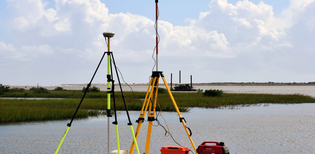
You will acquire skills in working with state-of-the-art geodetic instruments and software, such as GPS, unmanned aerial vehicles (drones), and geographic information systems.
You will learn to analyze geodetic data, create geographic information systems, and make informed decisions based on the information obtained.
You will work on projects that have direct applications in construction, infrastructure planning, land management, and environmental protection.
Professional Skills
A very strong emphasis in the training is the acquisition of necessary knowledge and skills to work with modern (geo)information technologies for collecting, visualizing, storing, and distributing data/information with the aim of studying the Earth system – geographic information systems (GIS), laser scanning, global navigation satellite systems, three-dimensional/four-dimensional (3D/4D) models below/on/above the earth's surface, and more.
Engineers in geodesy, cartography, and cadastre perform basic and specialized geodetic and cartographic activities, as well as specialized geodetic tasks in spatial planning, investment design, and construction.
CAREER PROSPECTS
The knowledge, skills, and competencies acquired during the training enable our students to pursue professional careers in state, municipal, and private companies, banks, state and local government bodies, design bureaus, research units and institutes, secondary and higher education schools, and more.
Educational Qualification Degree
Integrated Master’s Degree (MA)
Course Duration: 5 years
Is this PROGRAM right for me?
The "Geodesy" program is a perfect choice for you if:
- You love working outdoors and exploring the world around you.
- You are interested in technology and want to use state-of-the-art geodetic instruments.
- You value precision and want to participate in creating accurate maps and models.
- You have an analytical mind and love solving spatial problems.
- You want to be part of large infrastructure projects.
Learn about the application process, score calculation, and deadlines. See admission requirements >>
Program
According to the adopted curriculum for the "Geodesy" program, part of the regulated profession "Engineer in Geodesy, Cartography, and Cadastre" at the Faculty of Geodesy at UACG, the training is conducted in 10 semesters as follows:
- Semesters 1 to 8 include fundamental and general theoretical training;
- The 9th semester provides specialized training in six specializations;
- The 10th semester includes a pre-graduation internship, and the development and defense of a diploma thesis;
- The specializations are formed in the following areas: "Higher Geodesy", "Geoinformation Systems", "Applied Geodesy", "Photogrammetry and Remote Sensing", "Cadastre and Property Management", and "Cartography and GIS";
- Practical training is carried out through scheduled academic practices and the pre-graduation internship;
- The training concludes with the development and defense of a diploma thesis before the State Examination Commission.
The Faculty of Geodesy at UACG provides student mobility for studies and student mobility for placement within the European program for education, training, youth, and sport "Erasmus+".
Student mobility for studies allows for mobility in the program at another higher education institution abroad for one or two semesters, with a duration of minimum 3 to maximum 12 calendar months in one academic year. Currently, the partnering countries include 25 higher education institutions from 17 EU and non-EU countries.
Student mobility for placement (traineeship) provides the opportunity for an internship in another higher education institution or enterprise abroad.
If you have specific questions about admission requirements, please contact us.
+359 888 42 44 75
Office: P225
Reception hours: 10 am - 12 pm
foreign_adm@uacg.bg